A Schmidt hammer rebounds against an exposed cutting face just west of Hastings, its digital reading capturing the uniaxial compressive strength of the Te Aute limestone. Our field team sets up a Trimble total station across the gully while the inclinometer probe descends inside a grouted PVC casing, recording cumulative displacement at half-metre intervals. Hastings sits on a geological boundary where the alluvial gravels of the Heretaunga Plains meet the soft-rock hill country of the Rangitikei Supergroup, and that transition zone generates slope failures that standard desktop assessments consistently miss. The limestone benches near Havelock North can look stable for years before a wet winter triggers a wedge failure along a siltstone bedding plane. We combine piezometer readings, shear vane profiles, and CPT testing in the colluvium blanket to build a ground model that actually reflects what the inclinometer and standpipe data are telling us.
A slope with a computed FoS of 1.3 that ignores the residual strength of weathered Hawke's Bay mudstone is a failure waiting for the next cyclone.
Technical details of the service in Hastings
Risks and considerations in Hastings
The Heretaunga Plains experience a rainfall pattern that concentrates heavy precipitation in short, intense events driven by ex-tropical cyclones tracking south from the Coral Sea. When 150 millimetres falls in 24 hours on the greywacke-derived colluvium slopes south of Hastings, pore-water pressures spike faster than the drainage paths can dissipate them, and that is when the calls come in. We have measured suction collapse in the loessial cover across the hill suburbs—a phenomenon where the soil structure implodes on wetting, reducing the apparent cohesion to near zero within hours. Cyclone Gabrielle in 2023 was the brutal reminder that Hastings slopes cannot be assessed with dry-weather parameters alone. Our stability models therefore run transient seepage scenarios with rainfall hyetographs from NIWA's High Intensity Rainfall Design System, not just steady-state phreatic surfaces, so the factor of safety reflects the storm that actually threatens the site.
Our services
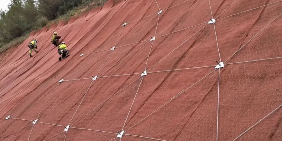
Every slope in Hastings has a different failure mechanism depending on whether it cuts through the Te Aute limestone, the Mapiri Formation mudstone, or the younger alluvial terrace gravels. Our assessment programme is tailored to the geology and the consequence class of the site.
Cut Slope Stability Assessment
For residential and roading cuts in the Hastings hill suburbs. We log the face geology with scanline discontinuity mapping, install inclinometers behind the crest, and run 2D limit equilibrium analyses calibrated to direct shear results from the actual weathered zone—not the fresh rock core.
Natural Slope Landslide Hazard Evaluation
Applied to larger landholdings and lifestyle blocks on the margins of the Heretaunga Plains. Combines aerial LiDAR interpretation, subsurface investigation with machine-dug test pits and CPT soundings, piezometer arrays, and finite element seepage modelling to map the phreatic surface through a wet season.
Fill Slope Design Verification
For engineered fills on the terrace margins where the underlying Plio-Pleistocene mudstone provides a low-permeability base. We test the fill material for compaction, shear strength, and collapse potential, then model the interface between fill and natural ground under both static and seismic loading to NZS 3404.
Questions and answers
What does a slope stability analysis in Hastings typically cost?
The fee range we see for a thorough slope stability assessment in the Hastings area is NZ$2,360 to NZ$6,190, depending on the number of boreholes, inclinometer installations, and the complexity of the modelling required. A simple cut slope on a single residential section falls toward the lower end, while a large fill embankment or a natural slope with multiple failure mechanisms and a full piezometer array moves toward the upper end. We scope each job individually after a site walkover.
How long does a slope stability investigation take from start to final report?
A typical programme runs six to twelve weeks. The field phase—drilling, inclinometer installation, test pitting, and sampling—takes about two to three weeks. Piezometers then need time to equilibrate and respond to seasonal groundwater changes, which is why we prefer to monitor through at least part of a wet season. Laboratory direct shear and triaxial testing adds another three to four weeks, and the modelling and reporting phase takes two to three weeks. Sites requiring urgent assessment can be fast-tracked by prioritising the critical cross-sections.
Do I really need inclinometers, or is a desktop assessment enough?
Desktop assessments using regional geology and LiDAR are useful for a preliminary hazard screen, but they cannot measure the actual shear surface depth, the rate of movement, or the pore-water pressure at the failure plane. Inclinometers and piezometers provide the empirical data that turns a generic model into a site-specific one. In the mudstone slopes around Hastings, we have repeatedly seen desktop models overestimate the factor of safety because they assume peak strength parameters that do not survive the first wet season after excavation.
What seismic loading do you apply to Hastings slopes?
We apply the seismic coefficients from NZS 3404 and the NZGS earthquake geotechnical guidelines, which account for the site's proximity to the Hikurangi subduction zone. The horizontal acceleration used in the pseudo-static limit equilibrium analysis depends on the slope consequence class and the site subsoil class, determined from shear wave velocity profiling or CPT data. For high-consequence slopes, we also run a Newmark displacement analysis to estimate the cumulative co-seismic deformation, not just a pass/fail factor of safety.