If you’ve worked sites near Havelock North and then down toward Flaxmere, you already know the ground doesn’t behave the same way. The alluvial gravels close to the hills give a false sense of security compared to the silts and sands sitting over the old river channels across central Hastings. In our experience, that difference is exactly where liquefaction analysis stops being a desk exercise and becomes a construction survival tool. We’ve seen boreholes 200 metres apart show completely different cyclic resistance ratios, simply because one hit a loose sand lens the other missed. Getting the analysis right here means understanding the Heretaunga Plains depositional system—not just running a spreadsheet. We run the full workflow: field investigation with CPT testing to capture continuous tip resistance and pore pressure data, sampling for lab-based cyclic triaxial when the project demands it, and then processing everything against the NZGS Module 4 framework to give you a clear yes/no on liquefaction triggering and settlement.
A single missed silty sand lens between four and seven metres depth can turn a low-risk site into a ground improvement job in Hastings.
Technical details of the service in Hastings
Risks and considerations in Hastings
The most common mistake we see on Hastings sites is assuming that a medium-dense sand with a clean SPT blow count will drain fast enough to avoid liquefaction—without ever measuring permeability or checking fines content. It’s an easy trap to fall into, especially on the light-industrial subdivisions between Omahu Road and the railway, where the top three metres look decent. The problem sits between four and seven metres depth, in a layer of silty sand that holds pore pressure just long enough to collapse during the cyclic shear of a moderate Alpine Fault or Hikurangi subduction event. We’ve walked onto jobs where the initial geotech report gave the all-clear, but a single in-situ permeability test run during a follow-up investigation reversed the conclusion. In Hastings, ignoring that intermediate layer isn’t a minor oversight—it’s the difference between a standard raft slab and a ground improvement contract worth six figures.
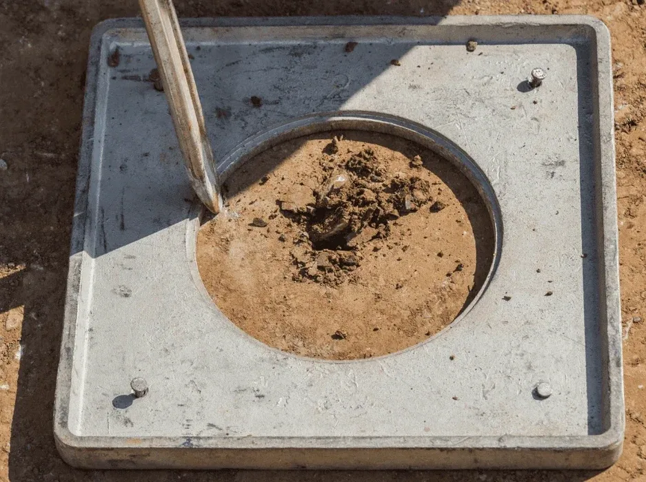
Our services
When we set up a liquefaction investigation in Hastings, we’re not just ticking boxes for a consent application. We build the program around the specific geomorphology of the site—paleochannel, overbank, or terrace—and then select the right mix of in-situ and lab methods to answer three questions: will it trigger, how much will it settle, and can we mitigate it economically?
CPT-Based Liquefaction Screening
We run 20-tonne CPT rigs through the Hawke’s Bay silts to capture continuous cone resistance, sleeve friction and pore pressure. Data is processed using the Boulanger & Idriss (2014) procedure, with soil behaviour type from Robertson (2016), aligned to NZGS Module 4.
Cyclic Triaxial & Lab Index Testing
Samples taken from Shelby tubes or block sampling go through our ISO 17025 lab for cyclic triaxial, grain size distribution, and Atterberg limits. We use these to calibrate the CPT-based correlation and confirm fines content—critical for the Hawke’s Bay silty sands.
Liquefaction-Induced Settlement & Lateral Spread Assessment
We model post-shaking volumetric strain using the Zhang et al. (2002) method, cross-checked with field case histories from the Christchurch sequence. Outputs include free-field settlement contours and lateral displacement estimates for sites adjacent to the Ngaruroro and Tukituki floodplains.
Questions and answers
At what depth do you usually find liquefiable layers in Hastings?
Most liquefaction-prone soils we encounter in Hastings sit between 1.5 and 8 metres depth, typically in silty sands and loose alluvium from old Ngaruroro River channels. However, we’ve also identified susceptible layers down to 12 metres in some areas near the floodplain, which is why we always recommend profiling to at least 15 metres when the site is within mapped liquefaction hazard zones.
What’s the typical cost range for a liquefaction analysis in Hastings?
For a standard residential or light commercial site, a full liquefaction analysis—including CPT soundings, lab testing, and an NZGS-compliant report—typically runs between NZ$4,050 and NZ$7,150, depending on the number of test points and whether cyclic triaxial testing is required.
Can you use SPT data instead of CPT for liquefaction assessment?
We can, and we often do when we’re working with existing borehole logs. SPT-based triggering (Seed & Idriss, 1971, updated by Boulanger & Idriss) is perfectly valid under the NZGS framework. But for new investigations, we push strongly toward CPT because it gives us a continuous profile—missing a thin loose layer with SPT is just too easy in the variable Hastings ground.
How long does the full investigation and reporting take?
Fieldwork is typically one to two days depending on access and number of CPT soundings. Lab testing adds eight to twelve working days for index and triaxial work. We usually deliver the draft report within three to four weeks from site mobilisation, and we can fast-track to two weeks if the consent deadline is tight.